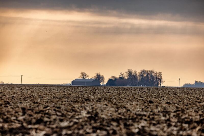
Drought, flooding, tornadoes, severe thunderstorms and extreme temperature swings: 2025 had it all, and it varied drastically by location, making last year a memorable one from a weather standpoint for many Illinois farmers.
State climatologist Trent Ford, with the Illinois State Water Survey, reviewed weather statistics from 2025 and events that stood out during a recent FarmWeek interview.
Precipitation – or lack thereof
Almost the entire state is abnormally dry or in some form of drought as a result of a shortfall of precipitation last year, according to the U.S. Drought Monitor released Jan. 15.
Preliminary statewide average total precipitation in 2025 was 31.78 inches, about 9 inches below normal. While official rankings by the National Oceanic and Atmospheric Administration had not yet been released as of press time, it is likely that 2025 will make the top 20 driest years on record statewide.
However, there was a lot of seasonality for precipitation last year, and the amount of rainfall varied immensely by region within the state.
January and February were drier than normal across the state, March was close to normal, and then April and May were huge precipitation months for southern Illinois.
“There were places that, coming into June 1, were having nearly their wettest year on record, especially the closer you got to the Ohio River and the Kentucky border,” Ford told FarmWeek. “There were places like Metropolis that were on par with some of the wettest years on record, including 1993, coming into the summer.”
But the consistent location of those storms in the jetstream through central and south-central Illinois meant a lot of the northern half of the state was getting missed.
June and July brought a little more equitable precipitation, including heavy rainfall.
“For example, Brownstown had 12 inches of rain in a single day. A couple weeks later, the Chicago area had an event where 5 inches of rain fell in 90 minutes,” Ford said.
Only two months – April and July – averaged wetter than normal statewide, and in central Illinois, every month was drier than normal except July.
“In many places in the central part of the state, we were drier than some of the most extreme drought years like 1988 and 2012,” Ford said. “But the reason we didn’t see catastrophic agricultural losses is because we got rain when it really mattered.”
Total precipitation in September and October was about only 3 inches statewide, less than 50% normal, making it the third driest August-to-September period on record in the state.
Total annual precipitation by town varied greatly. Metropolis had 67 inches of precipitation in 2025, about 23 inches more than normal, while parts of central and northern Illinois only got about 30 inches.
“There were a couple places in Champaign and Piatt County that only had 22 inches of precipitation in 2025,” Ford said. “It was the top 10 driest year on record in Peoria and Springfield; the 12th driest in Quincy; and the second driest in Champaign-Urbana, where we were only slightly wetter than 1894.”
And for the first time since 2021, Illinois was snowier than normal, especially later in the year. Some places around Decatur got 16 to 18 inches above average snowfall in 2025.
Slightly warmer than normal
Last year will be remembered by some for extreme temperature swings – especially in December, when some areas dropped more than 60 degrees in less than 24 hours after 60-plus-degree conditions on Christmas.
But statewide, the year averaged only 1 degree above normal temperature, making it the 20th warmest year on record.
February and December averaged below-normal temperatures, with May and August also slightly below. March and October were warmer than usual.
“We had a very early start to pretty intense warmth in March,” Ford said. “October was very dry and pretty warm across the state, which did help planting and harvest progress.”
Most of the state ended up between 0.5 and 2.5 degrees warmer than normal, with a bit higher temperatures in northern Illinois than southern Illinois.
It was the 15th warmest year on record in Chicago and the 20th warmest in Peoria.
Severe weather active, then tapers off
Last year began on track to beat 2024’s record for most tornadoes in Illinois. But active weather slowed down in the second half of the year.
“In 2024, we had 142 tornadoes, which was the highest on record. In 2025, the National Weather Service confirmed 126,” Ford said. “So, still about two times our long-term average, and certainly a top-three most-active tornado year.”
By July 1, Illinois residents experienced more tornadoes than in the first half of 2024, with 35 tornadoes in March, more than 45 in April, more than 20 in May and 25-plus in June – all above average for those months.
But severe weather became quieter by late summer, in general, with fewer than five tornados statewide each month from July through November, capped by 10 in December.
“We had some extremely dry conditions statewide from August to November, and when we have drought, we usually don’t have very much severe weather,” Ford said. “The drought in the fall that persisted across much of the state made it so that we didn’t break that tornado record two years in a row.”
Illinois finished second in the nation for most tornadoes in 2025, behind Texas.
This story was distributed through a cooperative project between Illinois Farm Bureau and the Illinois Press Association. For more food and farming news, visit FarmWeekNow.com.