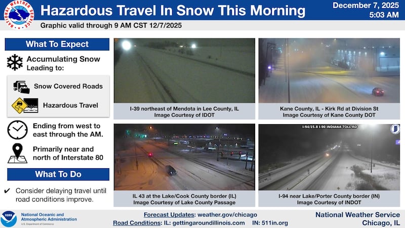
A quick-moving clipper system coated much of northern Illinois with several inches of snow early Sunday, creating hazardous travel conditions that are expected to linger into the late morning. A Winter Weather Advisory was in effect for areas along and north of Interstate 80, where the steadiest snowfall fell before daybreak.
Road cameras across the region showed snow-covered pavement and reduced visibility from Rockford to the Fox Valley. The Illinois Tollway and IDOT warned drivers to expect slick spots, drifting snow in open areas and slow-going conditions on major routes.
Some of the heaviest totals came from northwest Illinois, where Lanark reported 6.5 inches of snow as of 7 a.m. New Milford saw 6.2 inches, while 5.7 inches fell at Rockford Airport. Savanna picked up 5.3 inches.
Closer to the Chicago area, the snowfall tapered somewhat. Batavia measured 4.1 inches, O’Hare Airport reported 4 inches, and Midway saw 3.6 inches. Farther south, totals dropped sharply: the National Weather Service office in Romeoville recorded just 1.7 inches.
Forecasters expect the snow to end from west to east by mid- to late morning as high pressure builds into the region. However, the wintry weather won’t be over. A narrow band of lake-effect snow is expected to develop over Lake Michigan late this morning and shift inland through Sunday night. While additional accumulations should remain light, mostly a dusting to under an inch, brief bursts of snow could reduce visibility, especially in northwest Indiana and far northeast Illinois.
Temperatures will struggle to rise through the day, and northerly winds gusting up to 25 mph may cause some drifting on east-west roads. Lows Sunday night will drop into the single digits in areas that clear out.
Another round of light precipitation is possible Monday night into Tuesday near the Wisconsin border, with a stronger system bringing mainly rain Tuesday night before colder air returns midweek.
Drivers are encouraged to delay travel where possible until road conditions improve.
:quality(70)/author-service-images-prod-us-east-1.publishing.aws.arc.pub/shawmedia/59fc2deb-4690-4608-b846-d6af698839c4.png)