The National Weather Service’s Chicago Bureau hydrologist hedges his words when talking about when the flooding on the Fox River may recede, and where that will happen first.
If no more heavy rainfalls inundate the watershed, the river “may be within its banks by around the middle of next week,” hydrologist Scott Lincoln said on Tuesday. “It needs to stay dry to make that.”
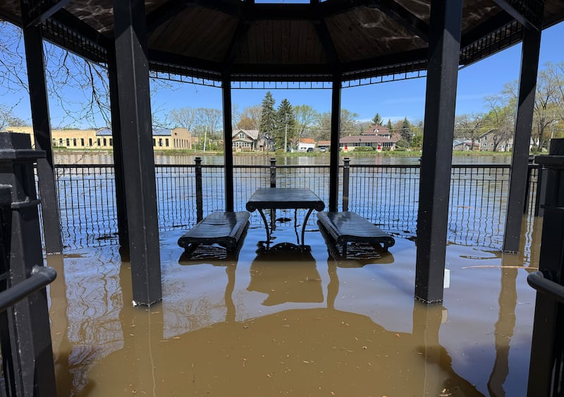
[ Photos from the Fox River flood of 2026 ]
While there is rain in the forecast, current models don’t indicate heavy rain events, he said.
But he also emphasized the “around” part. Lincoln’s making that forecast based on the current reading at the New Munster, Wisconsin, river gauge and historic data – while also recognizing it can take days for floodwaters to recede as the river heads south.
New Munster crested at 15 feet Sunday “and has been on a slow fall” since then, Lincoln said, adding that location “is the primary flow if water heading into the Chain O’ Lakes.”
It can take three to four days for downstream gauges to see floodwaters crest after New Munster does, he said.
That slow progression – along with mitigation efforts and changes to the riverbanks over time – are why the weather service needs residents to update them with changes on the ground, Lincoln said.
The Flood Impact information they use – what areas are likely to get flooded based on how high the river is – comes from a combination of places, Lincoln said, including county and town emergency managers and residents.
“We put that in the database [to indicate] that area will possibly get flooded” in the future too, Lincoln said.
Things can change over the course of the river, and in the course of a few years. If homes were bought out and replaced with riverside parkland, or if levies were put in place after the last flooding, it will change where water is going and their forecast, he said.
“A lot of things can happen. and there is no way to keep tabs on everything that has changed” unless residents and officials let them know, Lincoln said.
What he does know is what gauges on the river – many connected by satellite to the National Weather Service – tell him about current conditions.
What those readings are telling him now is that parts of the Chain O’ Lakes are in major flood state and are still slowly climbing.
Fox Lake, he said, was at “a fraction of an inch under major flood stage and climbing slowly” in Tuesday.
Water levels on the Chain aren’t necessarily consistent either.
“The lakes are spread out and don’t rise and fall like a bathtub. But generally – the Chain O’ Lakes are near major flood state and are still climbing slowly as of midday Tuesday,” Lincoln said.
To put this year’s flooding into context, the Fox Lake gauge was at 7.5 feet Tuesday.
“That is the highest we have has since July 2017, and that was higher at 8 feet,” Lincoln said. “We are a half-foot below what it was in 2017.”
Elsewhere, heading downriver, the tailwater at the Stratton Lock and Dam climbed to major flood stage overnight, Lincoln said.
On Tuesday afternoon, the McHenry County Division of Transportation closed about a mile of River Road from McHenry Dam Road to West Fernview Lane due to water over the road. The closed road is east of the Stratton Lock.
Rawson Bridge near Cary remains closed from Tuxedo Lane to the Broken Oar in Port Barrington. The McHenry County Sheriff’s Office reminded motorists not to cross the bridge or to drive around any barricades at flooded roads. Additional road closures are expected as the river continues to rise.
Via its Facebook page, Nunda Township announced Tuesday that it was ending its call for volunteers to help fill and place sandbags. That effort started last Thursday.
Below the Algonquin dam, water is expected to continue to climb through Thursday and reach 12.2 feet – major flood stage, Lincoln said.
The weather service does not have a gauge at Elgin, but gets daily updates from the Elgin Water Treatment plant employees. Elgin is expected to stay at or below minor flood stage and remain there even as the water does rise, Lincoln said
The difference in whether flooding is considered major or minor is that stretches of the river have different bank heights, he said, adding that the weather service takes into consideration if homes – life and property – will be affected by floodwaters.
“There are trails and parkland that are flooding in Elgin ... but it s pretty difficult to have flooding in Elgin proper,” Lincoln said.
At the South Elgin dam, the water levels have remained steady over the last few days, rising less than one-tenth of a foot.
The next gauge isn’t until Montgomery, where the water is expected to remain at minor flood stage for the next several days.
People may notice there is a long span of the river that does not have gauge readings, Lincoln said. That is because its up to communities – towns and county boards – to pay for the real-time gauges that report back to the weather service via satellite. If towns don’t regularly see flood damage, they may not want to pay for the gauge.
“That is the general, non community-specific answer,” Lincoln said.
To see flood predictions and the flood impacts, residents can to go water.noaa.gov. Questions and comments can be sent to nwps.webmaster@noaa.gov. The Chicago National Weather Service at Romeoville can be called at 815-834-0600.
:quality(70)/s3.amazonaws.com/arc-authors/shawmedia/185fbfd8-8216-43d7-8beb-cd8992be6fe5.png)