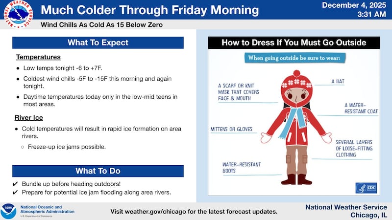
Northern Illinois is locked in a brief but brutal blast of Arctic air on Thursday, with temperatures plunging near zero in many areas and wind chills falling as low as 15 degrees below zero. The cold snap arrived behind a sharp cold front that moved through the region on Wednesday afternoon.
Even as winds have eased through the early morning, the combination of falling temperatures and lingering northwest gusts pushed wind chills to dangerous levels. The National Weather Service expects little relief during the day. Despite sunny skies, the fresh snowpack across the region will limit warming, keeping highs in the teens to the lower 20s.
The coldest readings are expected early Thursday evening again as clear skies and light winds promote rapid cooling. Some locations may slip below zero shortly after sunset before temperatures level off and slowly rise overnight as south winds return. Wind chills may again reach around 15 below zero before conditions begin a gradual warm-up into Friday.
While the main headline is the cold, forecasters are also tracking several chances for light snow as a parade of fast-moving “clipper” systems slides across the Midwest. The first will arrive Friday night, bringing a low-impact chance of light snow mainly north of I-80. Additional weak systems are possible through the weekend and into early next week, with another round of light snow possible Saturday night into Sunday.
Snow cover is expected to remain in place thanks to below-normal temperatures through the period, although a potential mid-week warmup could introduce a mix of precipitation types. For now, the most immediate concern remains the arctic cold. The National Weather Service urges residents to limit time outdoors, bundle up and watch for icy conditions.
:quality(70)/author-service-images-prod-us-east-1.publishing.aws.arc.pub/shawmedia/59fc2deb-4690-4608-b846-d6af698839c4.png)