Northern Illinois is bracing for a two-day stretch of severe weather, with storms expected to impact the region Tuesday afternoon before a more significant threat arrives on Wednesday.
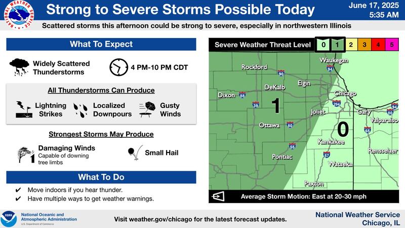
The National Weather Service has placed a large portion of northern Illinois under a Level 1 of 5, or “marginal,” risk for severe thunderstorms on Tuesday, June 17. The risk area primarily covers regions west of the Chicago metro area, including the Rockford, Dixon, and Ottawa areas.
Forecasters expect scattered storms to develop between 4 p.m. and 10 p.m. The strongest of these storms could produce damaging wind gusts capable of downing tree limbs and small hail. All storms will be capable of producing lightning and localized downpours as they move east at 20 to 30 mph.
The threat is forecast to intensify and expand on Wednesday, with a Level 2 “slight” risk covering most of northern Illinois. A Level 3 “enhanced” risk sits just to the southeast.
:quality(70)/cloudfront-us-east-1.images.arcpublishing.com/shawmedia/DX3MDPSLRZDKVIVEBESX4D27BA.png)
Wednesday’s storms, expected in the afternoon and evening, could bring a host of hazards. The NWS warns that damaging winds, large hail, and even a few tornadoes are possible. Additionally, a Level 1 of 4 flooding risk has been issued for the region due to the potential for torrential rainfall that could lead to flash flooding.
Residents across the area are advised to stay informed on the latest forecasts. The National Weather Service urges everyone to have multiple ways to receive weather warnings and to move indoors immediately if thunder is heard.
:quality(70)/author-service-images-prod-us-east-1.publishing.aws.arc.pub/shawmedia/59fc2deb-4690-4608-b846-d6af698839c4.png)