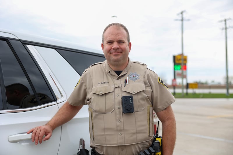
Sean Berry, a deputy sheriff with the Kankakee County Sheriff’s Office, is a self-described weather geek.
He went to Northern Illinois University, where he majored in meteorology.
Berry said he is 20 hours short of his bachelor’s degree.
“I got an opportunity to make money and not be a poor college student, so that’s what I did,” Berry said.
It was 1990 when Berry said he became interested in the weather.
Berry said when he was 8, the Plainfield tornado struck in 1990.
“I think that was the first time I remember hearing the sirens for something other than a test,” Berry recalled recently. “[Meteorology] always sparked an interest from that point forward.”
Berry’s uncle worked for the Will County Sheriff’s Office and spent the next two weeks in the Plainfield area as residents and businesses got back up.
“I was always interested in the research side of the weather, and the whole storm spotting thing and all that kind of goes hand-in-hand with emergency management,” Berry said.
Since his NIU days, his work in emergency management, storm chasing, and law enforcement maybe should be considered for those 20 hours needed.
For the past 3 1/2 years, Berry has worked with the Kankakee County Sheriff’s Office.
Whether he is on the job or on his off time, Berry will pay attention when the winds start howling, the clouds turn dark gray, and there is a dip in temperature.
On March 10, Berry was coming off his day shift.
He talked to emergency management personnel and a patrol commander about what could be coming.
A stationary warm front was situated south of Interstate 80. It was augmented by a breeze from Lake Michigan, Berry said.
“I said that the lake breeze is going to punch in. It’s probably going to start shoving that front south, and it did,” Berry said. “And if you remember, by about 1 or 2 o’clock in the afternoon, we had fallen back into the low 50s.”
If that front stayed further south, the chance for severe weather would decrease. However, the front moved back north, hovering around Illinois Route 17, Berry said.
“I was looking at a couple of high-res models that refresh every hour, and one of them in particular had that frontal boundary kind of waffling back north by early evening. And that’s exactly what happened,” Berry said. “So the lake breeze came in, reinforced the boundary, shoved it to about the Iroquois County line. Then it started mixing back north.”
Berry said the storm got its start in Livingston County and moved into western Kankakee County.
Around Limestone, the storm intensified, Berry said.
“We started getting some pretty rapid rotation,” he said.
Knowing that extremely dangerous storms were forecast, he drove home and switched to his personal vehicle, a truck equipped for a weather spotter.
“The radar can show the rotation in the thunderstorm. It doesn’t necessarily always show that there’s, in fact, a tornado on the ground. So it becomes a messaging issue,” Berry explained.
“So the weather service likes to have that ground truth.”
That proved vital information on March 10.
Berry tracked the storm and relayed information to officials.
How does the storm compare to others to hit the area?
“It’s the worst damage that I’ve personally seen with my own eyes,” Berry said.
Will he ever get back to finishing up the 20 hours?
“I still enjoy the heck out of it as a hobby. And again, I was more interested in the research side of it than being on TV, or doing the weather or anything like that, that didn’t really interest me. But, I don’t know, maybe someday I’ll finish it up,” Berry said.
:quality(70)/author-service-images-prod-us-east-1.publishing.aws.arc.pub/shawmedia/56d71ceb-065f-4b89-a313-e8a4268a29ca.png)