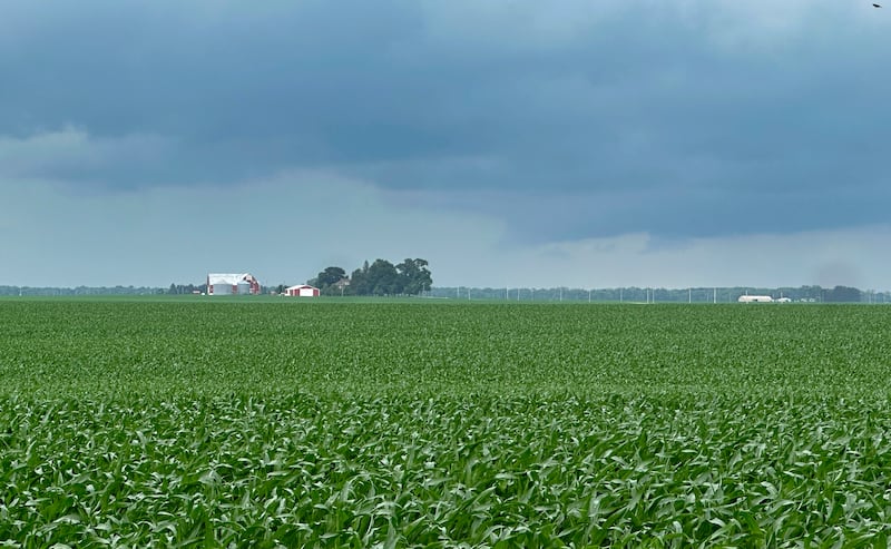
Notice that your grass had been dry and crunchy? The Illinois Valley has recently entered a drought and needed the rains that drenched us Sunday and Monday.
But if the 10-day forecast is correct, then we could all be crying “uncle” by midweek. Flash flooding looks like a short-term concern and county officials are warily eyeing a cold front expected to bring storms into the region Wednesday and Thursday.
A heavy downpour Sunday into Monday appears to have had no major impacts – La Salle County Sheriff Adam Diss reported no flash floods – but Diss urged all residents to exercise caution in light of a soggy forecast to kick off the work week.
“It looks like it’s not stopping until at least Wednesday,” Diss said.
And maybe a lot longer than that. AccuWeather shows at least a 35% chance of rain through June 17, with only a one-day break forecast next Monday.
The bigger worry is a midweek risk of severe weather. La Salle County Emergency Management Agency issued an advisory for residents to tune in to weather alerts on Wednesday and Thursday, when the risk of severe weather hits a 3 on a 5-point scale.
“We could get some severe weather depending on which way this storm decides to move,” said Fred Moore, director of La Salle County Emergency Management Agency.
Specifically, the key slots to watch are Tuesday night and early Wednesday, which could bring strong thunderstorms and wind gusts, and then Wednesday night and into early Thursday, when a “squall line” will pass through and make its presence felt.
“It’s a very active week from a weather perspective,” said David King, a meteorologist with the National Weather Service in Romeoville.
King urged residents to watch for updates. Moore further recommended keeping smartphones charged and weather radios handy.
:quality(70)/cloudfront-us-east-1.images.arcpublishing.com/shawmedia/2AAJV5G35ZDD3G5GPFDNXMXGOY.jpg)
“Don’t rely on listening for tornado sirens with the air-conditioning going,” Moore cautioned.
Ideally, the severe weather won’t come to pass, but the rain will keep coming, though hopefully less torrentially than it did at times Sunday and Monday.
David Isermann, president of the La Salle County Farm Bureau, said the region had recently entered a moderate drought and the weekend rains were welcome – indeed, very nearly when needed.
Isermann said farmers had enjoyed two weeks of dry, sunny days to complete spring planting – “It was good for making hay,” he said– and then came a good soaking. Isermann farms in rural Streator, where he recorded 3½ inches in the past three days.
“This rain is coming at a really good time,” he allowed. “The only thing is a lot of it is running off because it was coming in too fast.”
Slower, lighter storms would be welcome because the Illinois Valley remains, according to a June 4 update of the U.S. Drought Monitor, in a “moderate drought.” It’s a good bet the Thursday update will show improvement across Northern Illinois.
Prolonged rains could cause problems along the Fox and Illinois rivers, but as of Monday, there were no short-term worries. The Illinois River at Starved Rock Lock and Dam stood 6 feet below flood stage. The Fox River at Dayton stood about 5 feet below flood stage.
Neither was projected to enter flood stage, but recent years have seen such forecasts revised abruptly and to significant levels.
:quality(70)/s3.amazonaws.com/arc-authors/shawmedia/638ad18c-1176-4018-bcef-b5560cf36d58.png)